This year, I had the pleasure of spending my summer holidays hiking in Tatra Mountains, in the south of Poland. It’s one of my favourite places in the world, and it’s truly beautiful! Last week, I took you on a hike to Kasprowy Wierch, one of Poland’s most famous mountains. Today, I’m taking you to Czerwone Wierchy – a long but picturesque trail through 4 mountain peaks. It includes some of the easiest to climb peaks over 2000 metres above the sea level that you can find in Poland. Join me on the photo trip!
Getting to the start of the trail
You can get to Czerwone Wierchy in a few different ways. We decided to start our hike in Kuznice. This time, our hike didn’t end in the same place as the starting point. We took a bus from Zakopane to Kuznice and didn’t have to worry about returning to a parked car. However, you can drive to Kuznice too, there are a few car parks in the area.
Quick stop at Hala Kondratowa
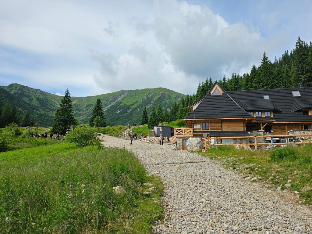
Once we got to Kuznice, we followed the blue trail to Hala Kondratowa, where you can find a small mountain shelter with a restaurant and toilet facilities. It will be a while until the next hostel on this hike! We made sure to collect our stamps from Hala Kondratowa – most mountain shelters in Poland have unique stamps. This time, the stamp station was outdoors, on one of the windowsills.
If you’re after stamps, you can take a small detour on the way from Kuznice to Hala Kondratowa and walk through Kalatowki – a larger shelter, which also has its own stamp. We had already collected that stamp on a previous day, so we decided to walk straight to Hala Kondratowa.
From Hala Kondratowa to Kondracka Przelecz
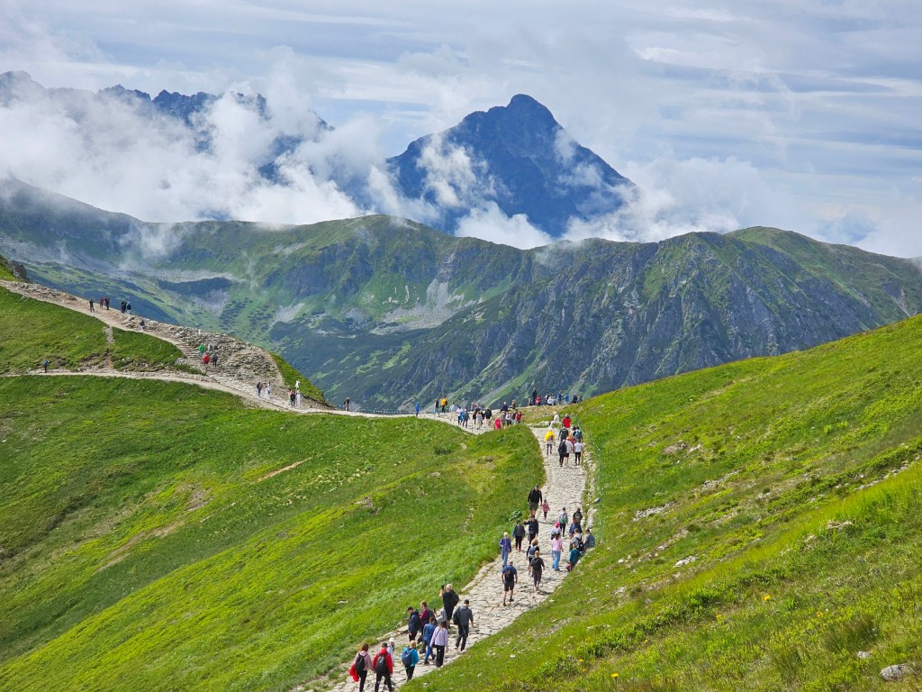
There are usually many people in Hala Kondratowa, most of them aiming to climb Giewont – one of Poland’s most famous mountains. To get to Czerwone Wierchy, we followed the blue trail, which also leads towards Giewont. The trail was quite busy – you certainly couldn’t get lost there!
The route to Kondracka Przelecz is quite steep, but not in a dangerous way with lots of exposure. It’s just a proper cardio workout! It might be challenging, but the views make up for it. After about 40 minutes, we got to Kondracka Przelecz.

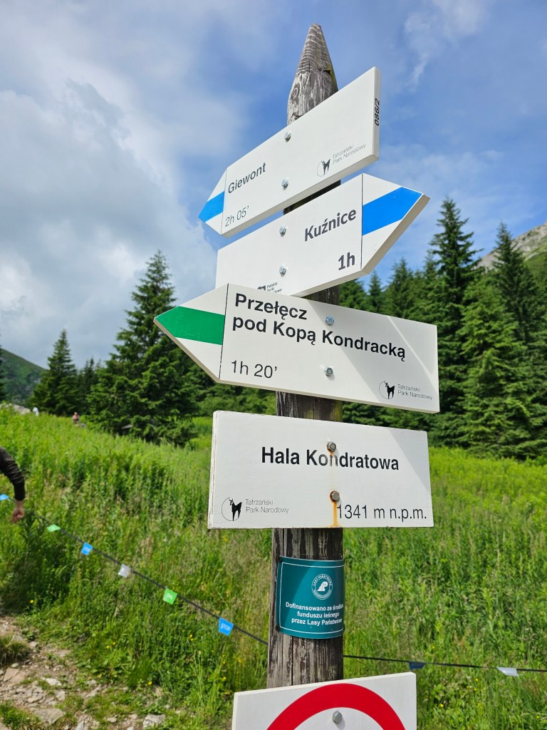
Ascent to the start of Czerwone Wierchy – Kopa Kondracka
Kondracka Przelecz is just a stone’s throw away from Giewont. From there, you can clearly see the metal cross at the top of Giewont, and the queue of people climbing the peak of the mountain. We, however, had different plans for the day.
We went in the opposite direction, taking the yellow trail towards Kopa Kondracka. It’s the first of four peaks of Czerwone Wierchy. At 2005 metres above sea level, it’s the first time during this hike that we were above 2000 metres. It gets better, though!
The hike from Przelecz Kondracka to Kopa Kondracka was quite steep too. You might notice that it’s a repeating pattern on this hike. There was lots of uphill walking that day.
The mountain tops in that area of Tatra Mountains are vast and flat. You won’t see a sharp ridge there; instead, you’ll see a path leading up and down some rounded hills. But, make sure to stick to the trail! There are still places in that area with sudden drops and near-vertical walls.


Czerwone Wierchy Hike
Once we were at the top of Kopa Kondracka, that’s where the real Czerwone Wierchy hike was about to start. The red trail covers four peaks, Kopa Kondracka being the first of them. Next, there are Malolaczniak (2096m), Krzesanica (2122m), and Ciemniak (2096m).
The trail wasn’t entirely empty, but the handful of hikers that we could see in the distance was nothing compared to the crowds near Giewont. Czerwone Wierchy isn’t a hugely popular trail, probably mainly because of its length, lack of tourist facilities, and being from civilisation overall. Plus, once you’re on that trail, there aren’t many opportunities to cut it short and start an early descent.
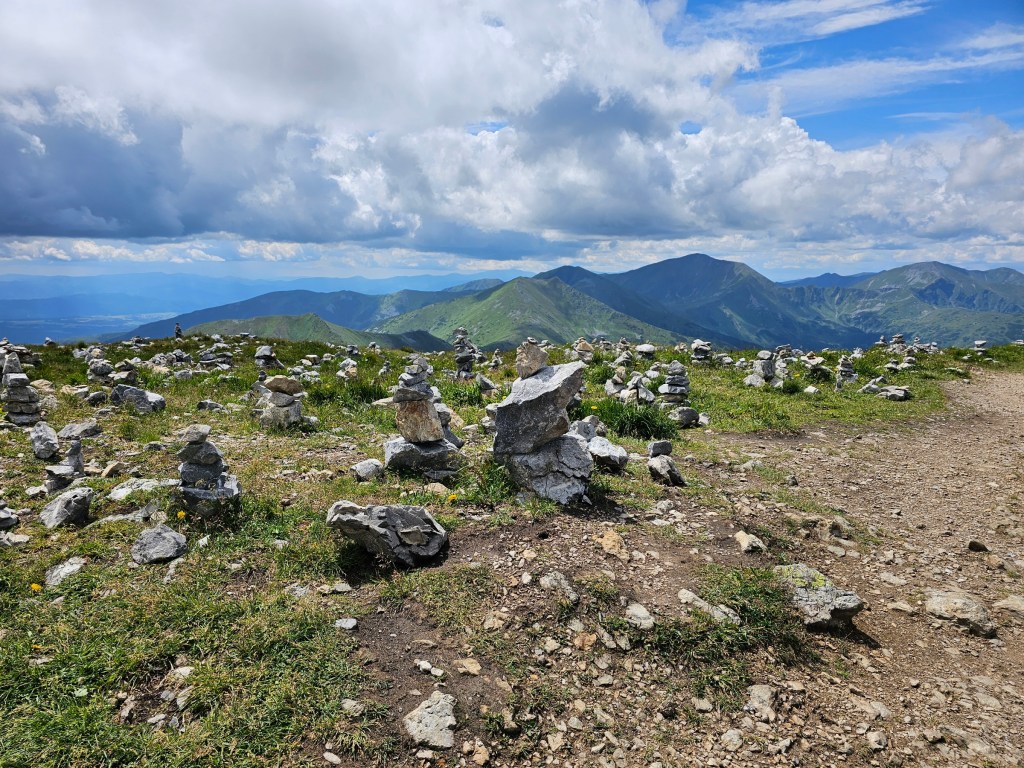
Krzesanica was the highest of the four peaks, and the highest point of our hike. In fact, located at 2122 metres above sea level, it was the second highest peak of our holidays! When we got there, we were stunned by a large number of stone structures assembled by hikers. They were everywhere you looked, covering the whole peak of Krzesanica!
Overall, the hike between Kopa Kondracka and Ciemniak – the Czerwone Wierchy trail – wasn’t too challenging. It was, however, quite long, with a surprising level of ascent and descent. The path connecting the four peaks went up and down, making the hike a good exercise.
It was really windy on the trail too. There was nothing to shelter us from the chilly wind, and we were thankful for windbreaker jackets.


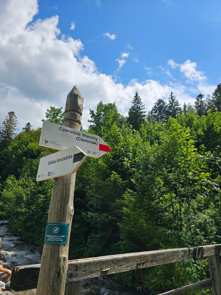
Descent from Ciemniak to Dolina Koscieliska
Once we got to Ciemniak, officially reaching the end of Czerwone Wierchy, it was time to start the descent. There were a couple of trails to choose from: a green trail leading to Ornak shelter in Dolina Koscieliska, and a red one, also going to Dolina Koscieliska, but the other end of the valley, closer to the edge of the national park. We originally wanted to take the green trail to the shelter, but I had read online that it’s not a commonly used trail. That seemed to be reflected in reality – out of the handful of people we saw hiking to and from Ciemniak, no one was on the green trail. Considering that there are wild brown bears in Tatra Mountains and we really didn’t fancy encountering one, we decided against the green trail. Red trail it was!
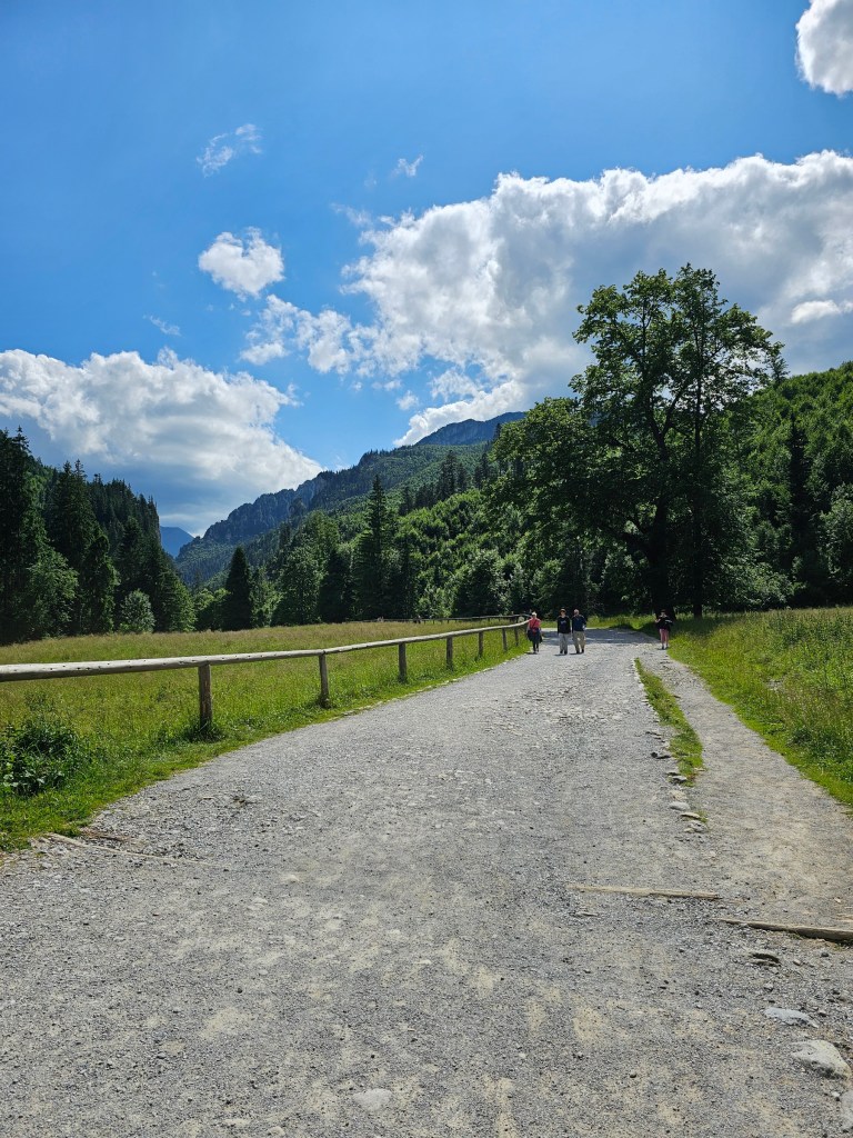
We started our descent to Dolina Koscieliska, and I really enjoyed that path, initially. There were vast meadows on both sides on the trail, filled with colourful wildflowers. After a rather long while, though, the meadows were replaced by a forest, and we could no longer enjoy the views.
At that point, we really started to feel the strain of our hike. I could particularly feel it in my knees – descending 1000 metres takes its toll. I like to think that I’m a fit person, but this hike was quite tiring! We didn’t take any breaks during the descent, we just wanted to get back down. It took us 2 hours to descend from Ciemniak to Dolina Koscieliska, but frankly, it felt like a lot longer. According to the signs, a hike back up to Ciemniak would be 3 hours 45 minutes!


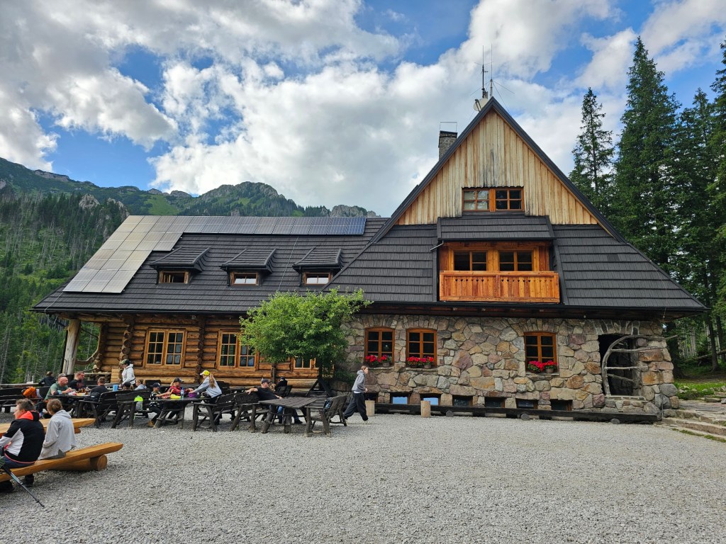
A walk to Ornak Shelter
Since we followed the red trail to descend to Dolina Koscieliska, we ended up near the exit from the national park. Despite being exhausted, we didn’t want to go back home just yet. Instead, we decided to walk along the valley to Ornak shelter, to get some refreshments and, most importantly, collect the stamps from the shelter.
Dolina Koscieliska is a fantastic place for a stroll. The valley is flat and doesn’t require great fitness levels. However, after a few long hours of intense hiking, even walking on a flat surface was challenging! It took us about 1 hour to get to Ornak, and we couldn’t be happier to see it. Our stop at the shelter in Hala Kondratowa in the morning was just a distant memory at that point.
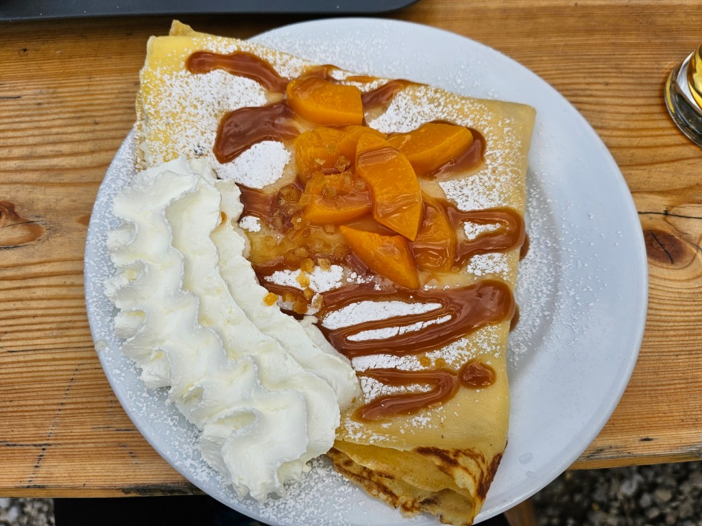
After collecting the stamps, we decided to order some food and drinks. I decided to go for something sweet, craving carbs and sugar. I chose a crepe with sweetened cream cheese, peaches, and whipped cream. It was delicious! We also ordered some cold beer – the first few sips were divine, filled with hydration and electrolytes, but I failed to finish the whole glass. I’m used to craft ales, and my tastebuds refuse to accept cheap, mainstream beer now!
Walking back to Kiry – summary of the hike
Once we finished our meal and got a bit of rest, we decided to head back to civilisation, following the green trail to Kiry. It took us just over an hour to get to the exit from the national park. From there, we took a bus to Zakopane.
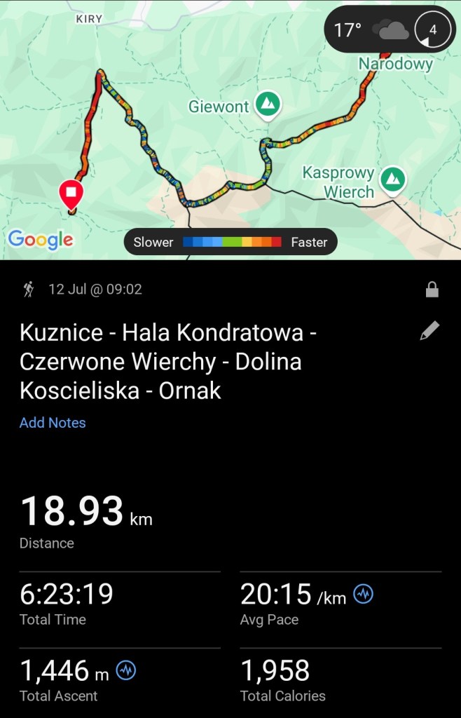
I accidentally stopped the tracker on my smartwatch when we were taking a break at Ornak shelter, so the final walk to Kiry was recorded as a separate activity. Overall, our hike was 25 kilometres long, with 1450 metres elevation gain. It took us over 7 hours 37 minutes to complete – breaks aren’t included in that time. It was a physically challenging hike, but the views were stunning!


Also see: