
Hiking is one of my favourite activities. Challenging myself with a demanding physical activity whilst surrounded by the sounds and sights of nature is my ultimate medicine and therapy. A long hike away from the hustle and bustle of the city helps me relax and find solutions to any problems. Sadly, the south east of England doesn’t offer many mountainous areas and options for a hike are rather limited – but they do exist, you just need to search well. Today, I’m taking you on a hike to Box Hill in Surrey Hills – a perfect place for a day trip!
How to get to Box Hill from London
My journey started at London Waterloo, where I took a direct South Western train to Box Hill & Westhumble. Around 45 minutes later, I got off the train and my hike began. It was around 9:15am.
Stepping stones
After leaving the station, I turned right and followed the road to the next junction. There, I took the subway to cross the busy road, then turned right. After a few minutes of walking along the road, I reached a small car park – the starting point of the trails.
There are two paths starting at the car park. The one on the right will take you straight to the Stepping Stones. The one on the left will take you to a footbridge. You get to choose how you cross the river. 🙂 Both paths merge into one on the other side of the river, and the most challenging part of the hike begins.

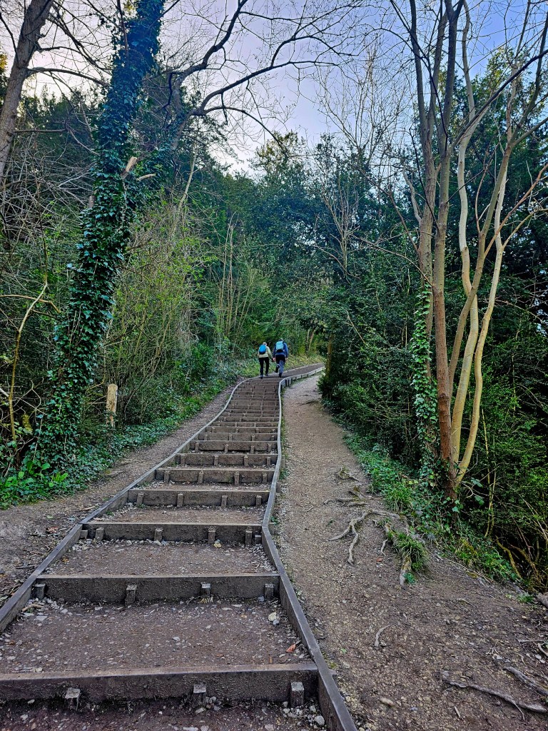
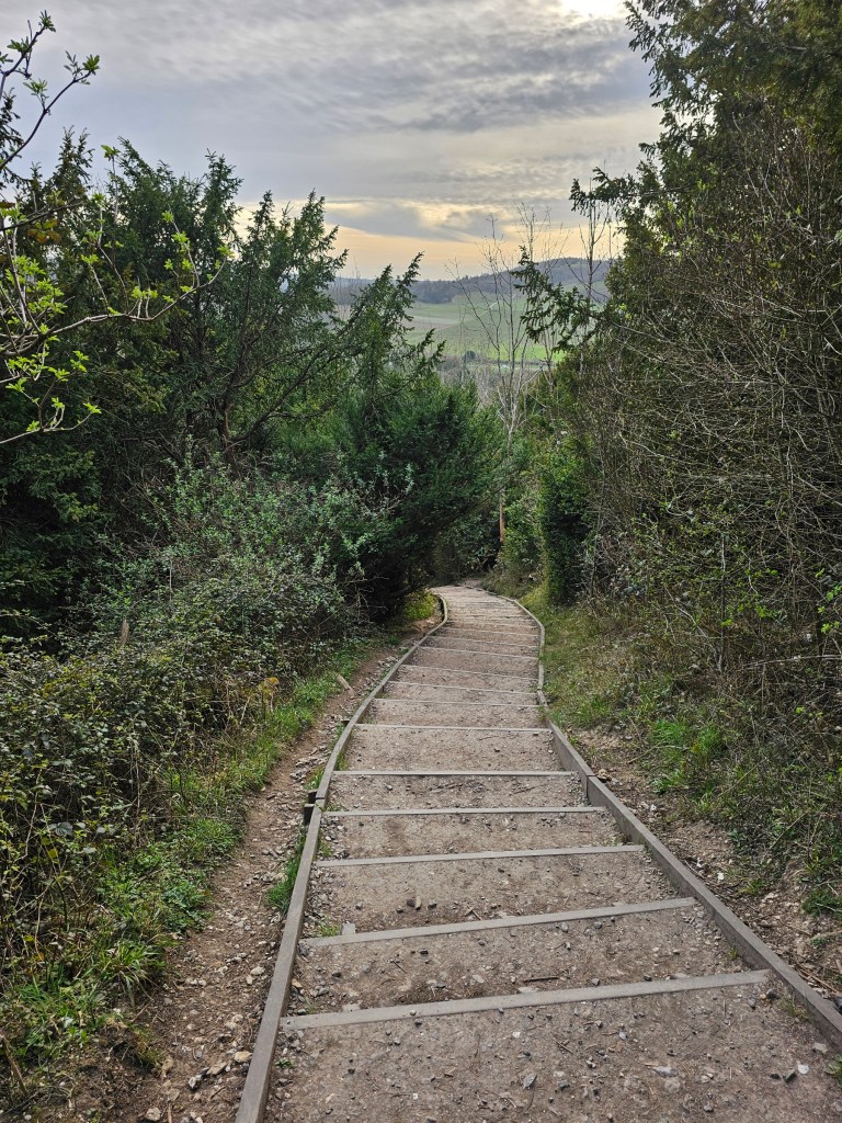
Ascent to Box Hill viewpoint
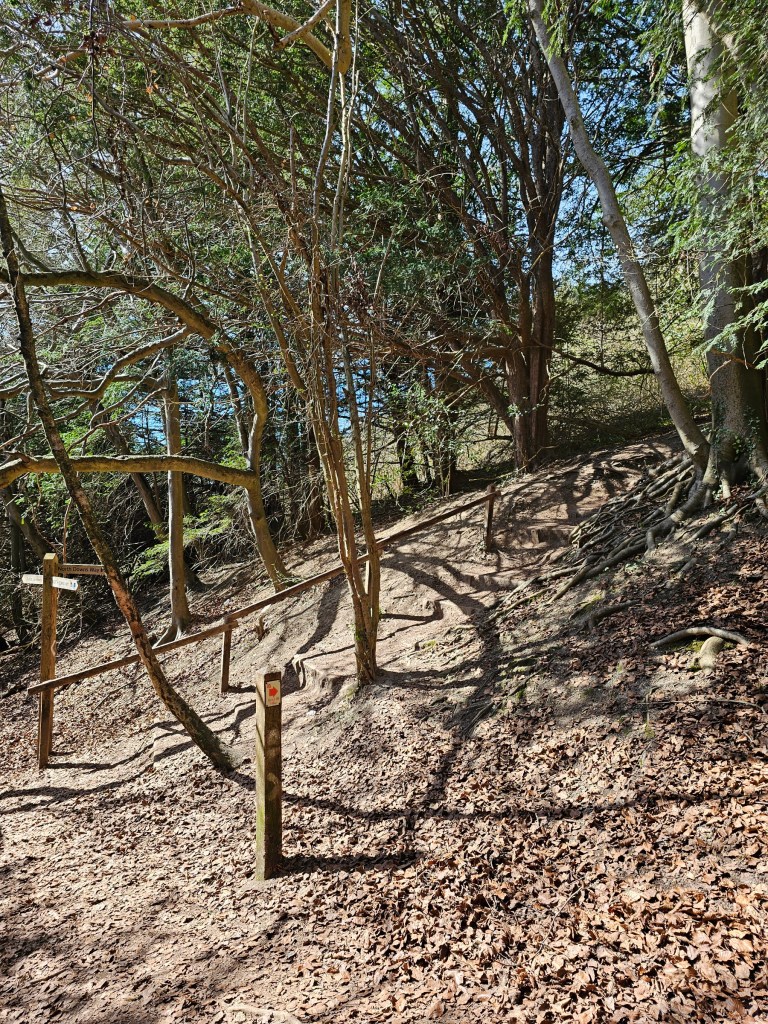
The path starts to go uphill, with a semi-natural staircase. Your stamina will be tested! The climb is relatively short – around 15 minutes – but it’s long enough to catch you out of breath a few times. The south of England is pretty flat, and I was surprised to discover that it is indeed possible to get tired whilst hiking so close to London!
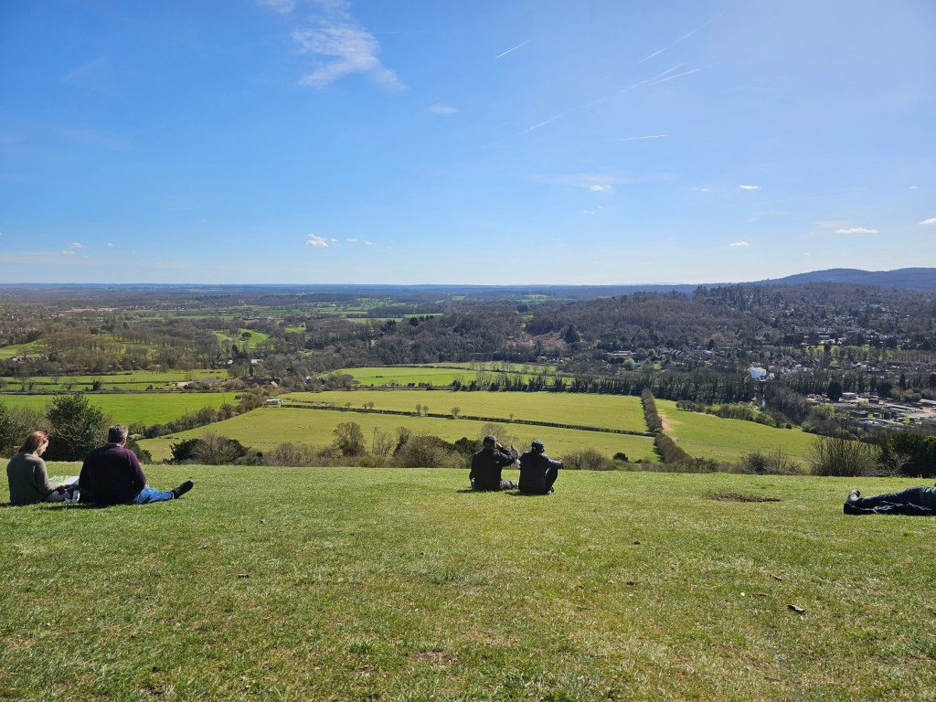
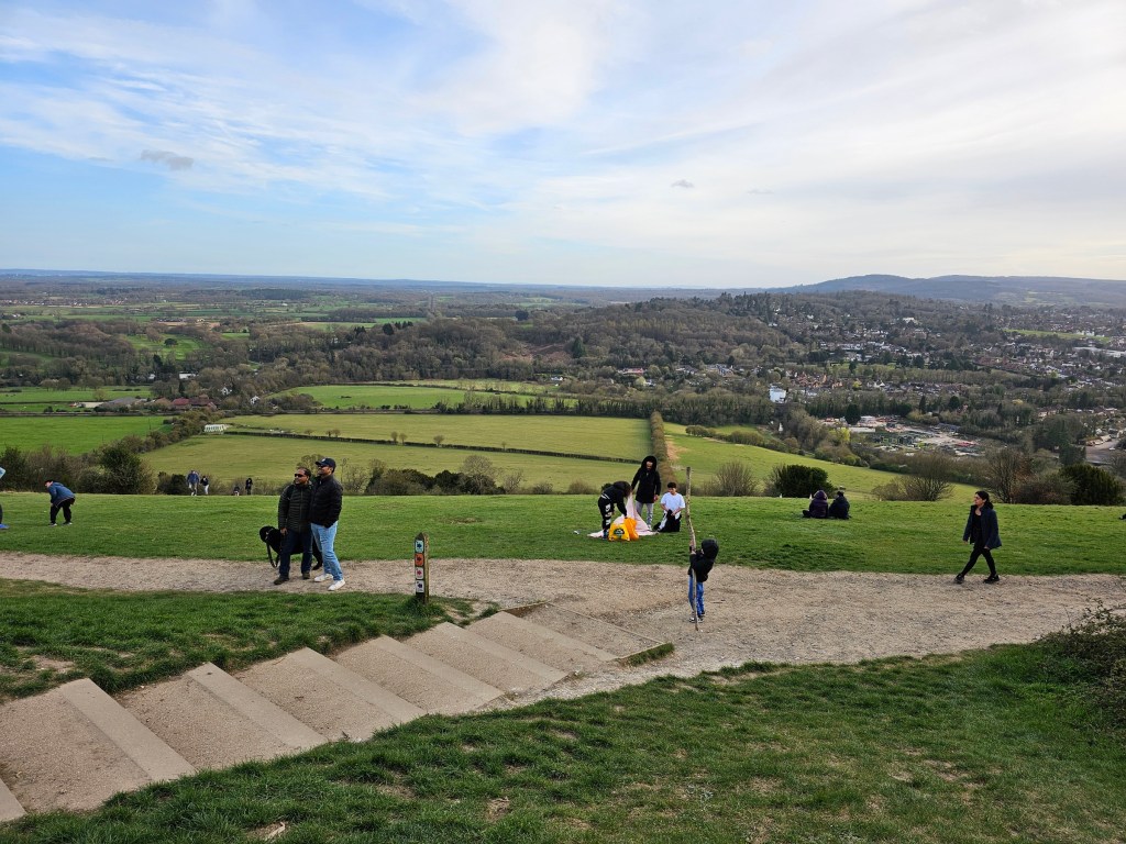
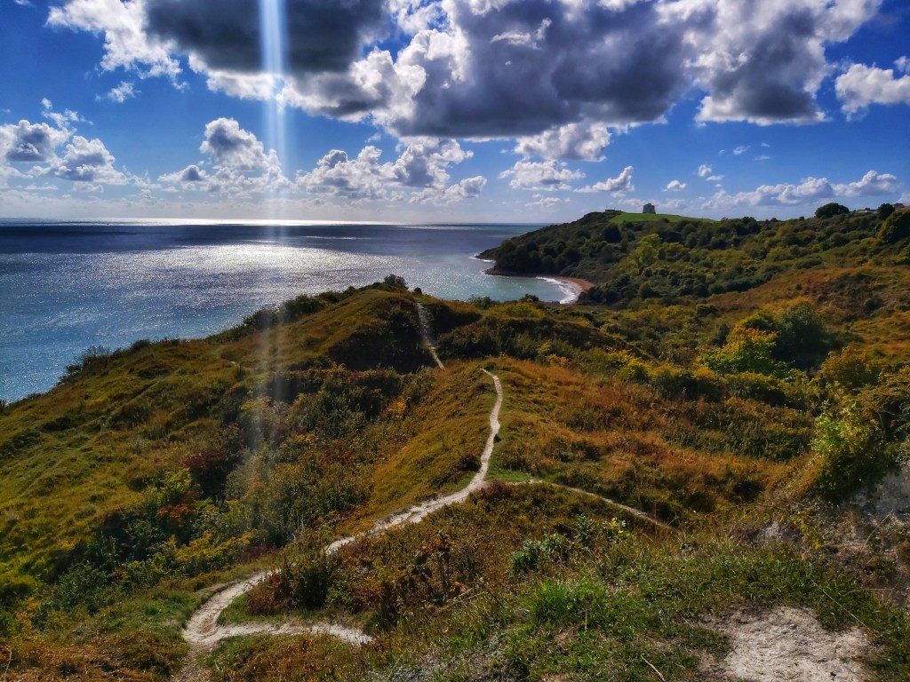
The climb might be tiring, but you’re rewarded with a lovely view. Perfect place to sit down, eat and rest.

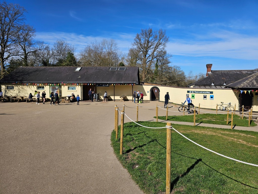
National Trust Box Hill café
Near the viewpoint – just a couple minute’s walk away – is the visitor centre. I always appreciate having access to services and facilities near a hiking trail! There’s a large cafe at Box Hill, as well as toilets and drinking water. There’s also an information board with a map of all the nearby hiking routes.
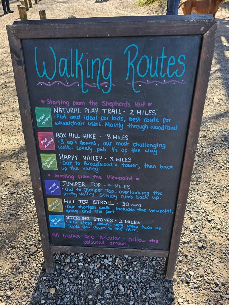
Box Hill Hike Trail
Setting off
I started with the longest trail, named Box Hill Hike. All of the routes are relatively well signposted, but it helps to download written instructions from the National Trust website (you can find them here). There were a couple of places where it wasn’t obvious to me where to go, and one place where I didn’t spot the signs.
The Box Hill Hike is 8 miles long (12.8 km), and is estimated to take around 4-6 hours. I ended up completing it in under 3 hours – I’m a seasoned hiker, I walk quite fast and I didn’t really take any breaks.
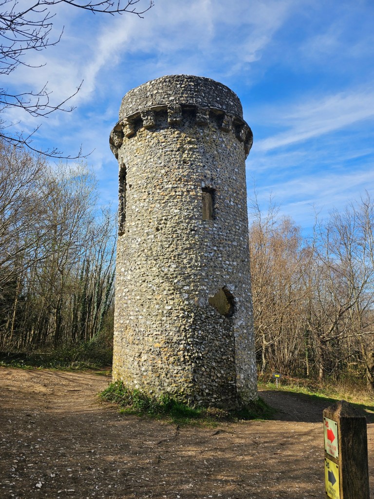
Broadwood’s Tower and first ascent
The first part of the trail took me to the Broadwood’s Tower, and then down to the valley where you turn left (there’s a sign at the bottom of the valley which I missed). I followed the trail until I reached a small car park and the first steep climb of the Box Hill Hike. Once again, it was a kind of a semi-natural staircase. It was convenient to walk on, and the challenge was in the fact that the ascent was quite long.
Mickleham village
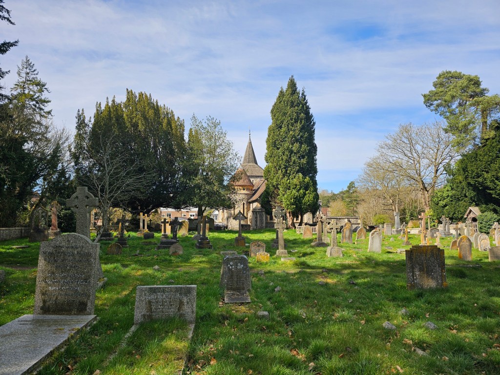
Around the 1/3 mark of the Box Hill Hike trail, there’s the cute Mickleham village. You can take a break and explore the area here, or enjoy a pint at the pub. The trail isn’t signposted very well in this area. To continue the hike, you need to cross the graveyard and follow the path with a tall wooden fence on the left.
Continuing the hike
I continued the walk, enjoying the views and tranquil surroundings, with an occasional surprise here and there. For example, there are two wrecked cars at one point of the hike, which must have been there for ages. I had been to Box Hill a few years ago, and the cars were there then already.


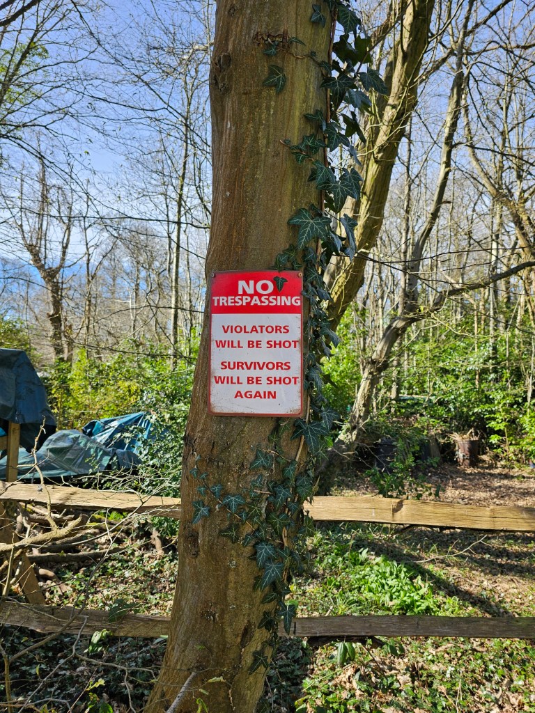
Another village
Part of the trail runs through a residential area with rows of cute cottages with well kept gardens. There was also a plot with what looked like some old machinery, and an interesting sign on the tree… I hope it’s a joke, no one keeps guns at home in the UK!
Back to Box Hill
Finally, I returned to the viewpoint at Box Hill and had a rest before resuming the hike. The Box Hill Hike route took me under 3 hours. At that point, I had done 15.8 km in 3 hours 57 minutes since leaving the train station.
I came to the trip well prepared, with a backpack full of fuelling food. I enjoyed a sandwich and some chocolate-coated cashews, as well as some coffee. I rested for around 35 minutes, then walked to the visitor centre to start another hike.
Juniper Top Trail
I chose to do the second-longest trail starting at Box Hill, Named Juniper Top. It is 4 miles long (6.4 km) and is estimated to take around 2 hours to complete. I ended up completing that hike in 1 hour 20 minutes .
Once again, I recommend downloading the written guide from the National Trust website, just in case the signposts along the hike aren’t good enough.
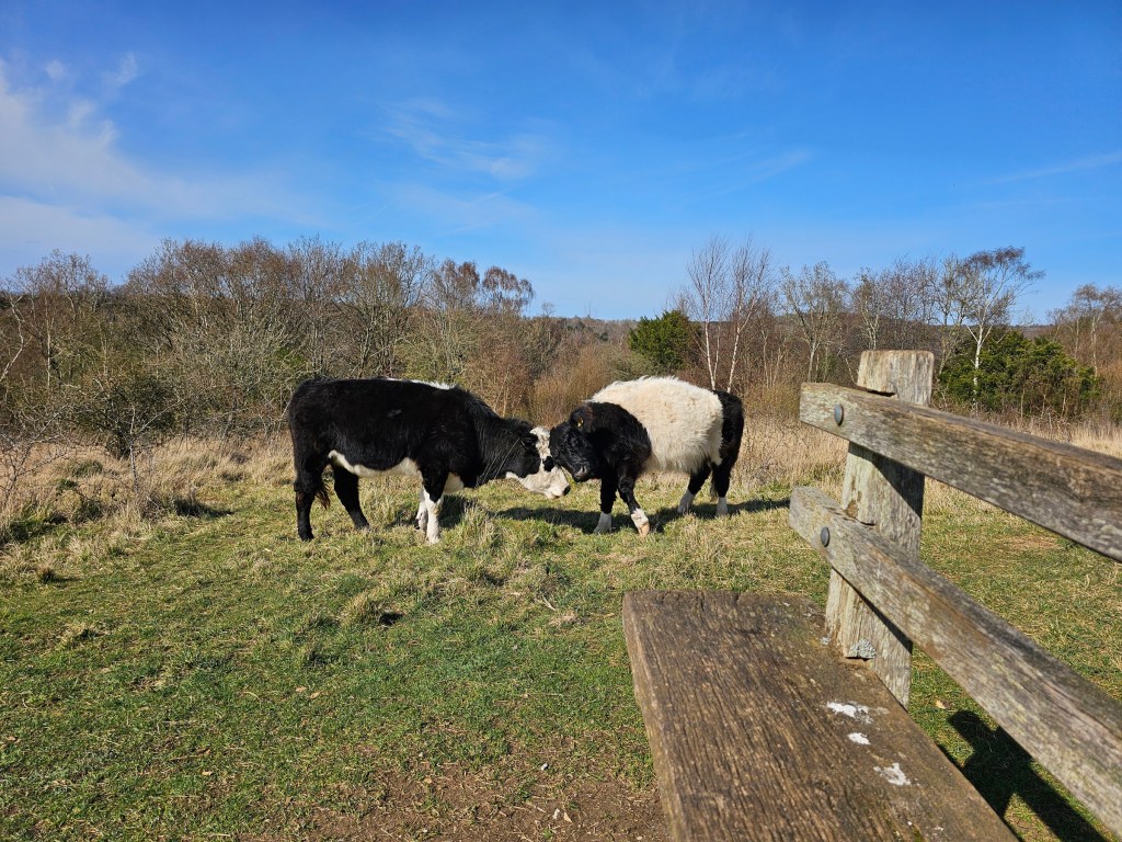
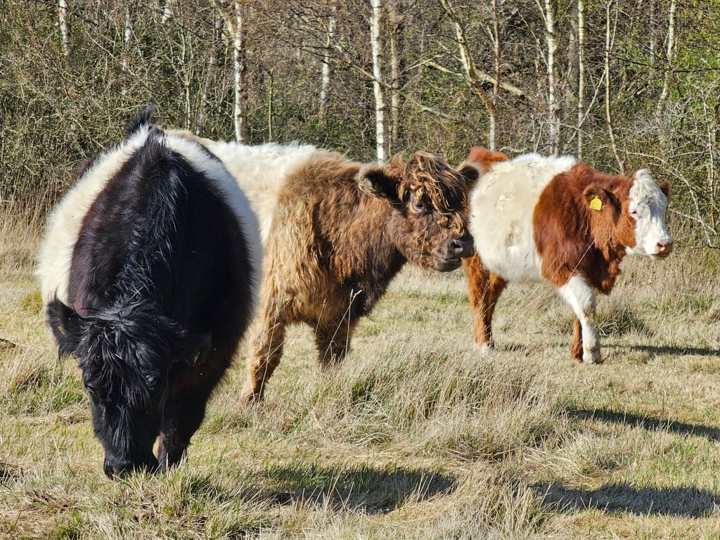
One of the things that surprised me in the UK when I moved here a few years ago was that a lot of public footpaths in the countryside lead through pastures in use. I’ve lived in large cities my whole life, and getting face to face with a cow never fails to excite me.
Back to Box Hill
I followed the trail and eventually reached Box Hill again. At that point, my watch was showing a total of 22.3 km and exactly 6 hours since I left the train station. I decided to take a short rest and then complete one more trail.
Happy Valley Trail
It’s worth noting that some of the official trails around Box Hill share some parts of the route. The Box Hill Hike and Juniper Top were largely separate, but the remaining, shorter routes utilise parts of them.
The Happy Valley trail runs along the Box Hill Hike at the start, and then merges to the final sections of the Juniper Top Trail. It’s probably a good choice for those who aren’t able to complete a longer hike but still want to enjoy a bit of a nature walk and some nice views.
The Happy Valley Trail is 3 miles (4.9 km) long and I completed it in 50 minutes before getting back to the Box Hill viewpoint, where I enjoyed some snacks whilst sitting on the grass and appreciating the views.
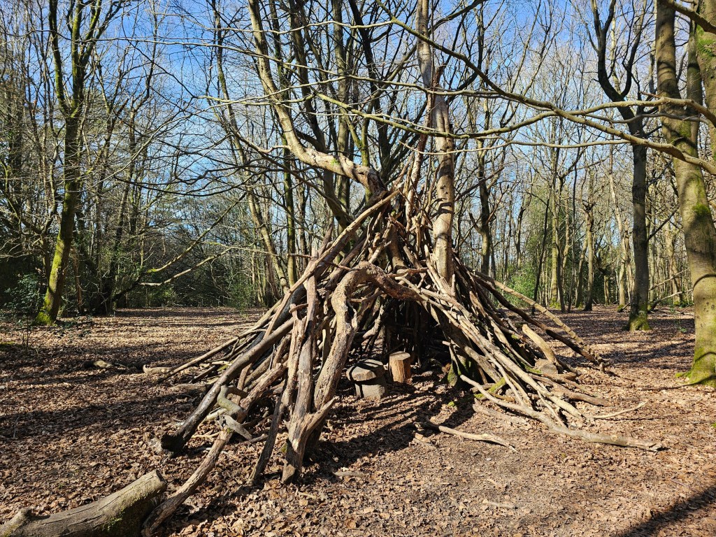
There are many interesting trees around Box Hill, as well as structures made of branches and tree stumps.


Way back home
Finally, it was time to go back home. I followed the same route that I took in the morning, down to the Stepping Stones and then to the Box Hill & Westhumble train station. At that point, I stopped the activity tracking on my watch. The full hike – from when I left the train station in the morning – ended up being 29.3 km and 7 hours 48 minutes. Phew! I didn’t pause the activity tracking during my breaks, they are included in the total time.
I didn’t time my return to the train station very well, not knowing how long it would take me to get there, and I ended up having to wait for around 30 minutes for my train. I used that time to do some light stretching exercises, which are absolutely essential after a long hike! Despite the long distance walked, I actually woke up feeling light and fresh the next day. In the past, I would typically feel slight lower back pain after long hikes (getting older sucks!), but I never stretched before the return journeys home. I actually believe that the stretching I did at the train station saved me from back pain the following day!
Eventually, the train arrived. 45 minutes later, I was back at London Waterloo. Slightly tired, but with lots of great photos and memories.
Also see:


Wow, the views there are so beautiful! You are lucky to be there. Here in Nevada, open-carry is permitted to those who pass the tests and have a clean background. I’ve seen people in petrol, gas stations with a pistol in a holster. Americans…
LikeLike